
Minaret of Jam - Hydrological Model
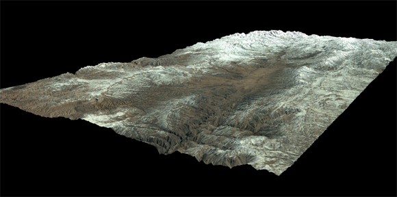
The Minaret of Jam (UNESCO-World Heritage Site) has for years been endangered by the bordering water courses that wash out the building. The Institute for the History of Urbanization (RWTH Aachen) in collaboration with the Institute of Hydraulic Engineering (RWTH Aachen) conducts researches how the building can be saved.
GEOSCAP delivered:
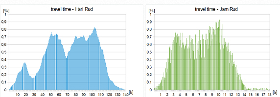
◌ Calculation of the water flow rate at the minaret based on a specially programmed hydrological model
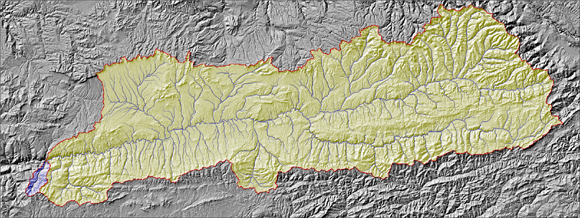
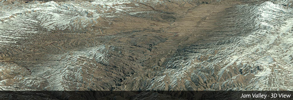
◌ Identification of the complete drainage area (Jam and Hari River) and the relevant parameters (elevation model)
◌ Temporally highly resolved precipitation rates and levels of snow coverage
Client: RWTH Aachen / UNESCO